By Jeff Gilmour, 4 April 2026
A recent article published by Reuters mentions that dozens of Chinese research vessels are on a quest to map the sea floor at strategic locations of the world’s oceans.[1] As noted in the article, it will give the People’s Liberation Army (Navy) (PLAN) a detailed picture of the maritime environment in which submarine battles may take place in the future.
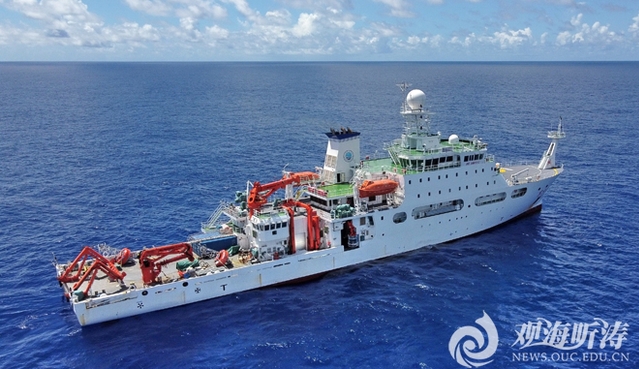
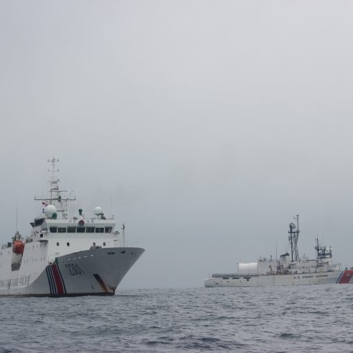
China is conducting an undersea mapping and monitoring program across all oceans, including the Arctic, ostensibly for climate, fishing and/or mining research. This exercise will increase its knowledge of marine conditions in these waters. In one example the author refers to Dong Fang Hong 3, a research vessel operated by the Ocean University of China, which spent 2024 and 2025 sailing back and forth in the waters near Taiwan and in strategic stretches of the Indian Ocean. The vessel also checked on a set of ocean sensors capable of identifying undersea objects near Japan.
US Navy officials say that the type of deep-sea data being collected by the ship is giving China a picture of subsea conditions. This information would be very useful if it needs to deploy submarines to hunt down those of its adversaries. Reuters has examined Chinese government and university records and analyzed five years of movements by 42 Chinese research vessels using a ship-tracking platform built by a New Zealand company. This indicates that the Chinese program is significant and widespread.
In recent testimony to a congressional commission, and as quoted in the article published by Reuters, Rear Admiral (USN) Mike Brookes, the commander of the US Office of Naval Intelligence, said China had dramatically expanded its surveying efforts, providing data that “enables submarine navigation, concealment and positioning of seabed sensors or weapons.” He also added that “potential military intelligence collection” by Chinese research vessels “represents a strategic concern.”
[1] Reuters, P. McKenzie, “China is mapping the ocean floor as it prepares for submarine warfare with the US”, March 23, 2026.
Image: A photo of the Dong Fang Hong 3 research vessel. Credit: Ocean University of China

5 thoughts on “Chinese Research Vessels”
This article makes clear why a non-stop Canadian Arctic naval presence, surface or subsurface, is essential in today’s world: “In recent testimony to a congressional commission, and as quoted in the article published by Reuters, Rear Admiral (USN) Mike Brookes, the commander of the US Office of Naval Intelligence, said China had dramatically expanded its surveying efforts, providing data that “enables submarine navigation, concealment and positioning of seabed sensors or weapons.”
PMSVs are designed to be economical to purchase and operate, and to have exceptional Arctic endurance: https://www.navalreview.ca/2022/12/the-case-for-a-polar-multifunctional-security-vessel/ . PMSVs are designed to live full-time in the High Arctic, not just visit it. Canada needs PMSVs to accompany Chinese Arctic “research” vessels every step of the way in Canadian and international waters. These PMSVs can utilize UAVs and UUVs to closely monitor, and examine in detail, the seabed sensors and weapons that Chinese “research” vessels leave in their wake. This knowledge, continuously updated, is militarily essential to Canada. Continuous updating provides effective, modesestly priced, training opportunities for the RCN and Canada’s trusted allies. The training opportunities offered generate revenue for Canada, further reducing the cost of the RCN’s PMSV fleet.
Yes, China is surveying the seabed. No one serious disputes that. But your leap from that reality to a fleet of hypothetical “live there full time” PMSVs shadowing every vessel in the High Arctic is where this falls apart. Canada does not maintain continuous presence anywhere in the Arctic today, not with the Royal Canadian Navy, not with the Canadian Coast Guard, and not with NORAD backed surveillance. And you think we’re suddenly going to conjure a fleet of unbuilt ships, with undefined logistics, basing, crewing, and sustainment, to tail every Chinese research hull “every step of the way”? That’s not strategy.
You keep calling PMSVs “economical”. Economical compared to what? A ship that can “live full time” in the High Arctic is not cheap. It requires hardened hulls, redundant systems, aviation capability, ISR suites, and a logistics chain that currently does not exist north of 60 in any meaningful, sustained way. Nanisivik isn’t a full naval base. Churchill isn’t a turnkey support hub. You don’t just park a concept ship in the ice and call it persistent presence. The Arctic punishes bad assumptions, and right now PMSV is built entirely on them.
And this idea of shadowing every Chinese vessel? With what legal authority and what rules of engagement? You’re describing a constant, resource intensive shadowing mission across one of the largest, harshest maritime spaces on the planet. Even the United States Navy doesn’t do that globally, and it actually has the fleet mass and logistics to try. Canada’s approach has always been layered awareness, not single-platform solutions. Satellites, patrol aircraft, allied intelligence sharing, and yes, periodic presence with ships like the Harry DeWolf class. That’s grounded in reality.
The UAV and UUV piece sounds impressive until you realize it depends entirely on being in the right place at the right time with the right support. You don’t get persistent underwater surveillance just because you bolted a drone bay onto a hull. You get it through networks, seabed systems, allied integration, and sustained funding over decades. Again, none of which exists in your PMSV concept.
And the revenue argument? That’s the tell. Militaries are not built around turning patrol time into a profit centre. Training with allies is valuable, absolutely, but it does not offset the capital and lifecycle cost of a new class of Arctic-capable vessels designed to operate year round in extreme conditions. That’s not how defence budgeting works in Canada, and pretending otherwise just undermines your credibility.
Canada absolutely needs better Arctic domain awareness. It likely needs more survey work, more undersea mapping, and more persistent sensing, especially as others map the seabed for military advantage. But that solution space includes dedicated survey vessels, expanded use of existing platforms like the Kingston-class and Coast Guard assets, and integration with allies. It does not start with inventing a ship class and assigning it every mission under the sun.
Right now PMSV isn’t a capability. It’s a placeholder for every problem you want solved without doing the hard work of defining requirements, costs, tradeoffs, and operational realities. Until that happens, it remains exactly where it is today: a concept trying to masquerade as a plan.
Every serious navy that operates submarines understands one basic truth: if you do not know the seabed, you do not control the undersea fight. What the PLAN is doing with vessels like Dong Fang Hong 3 is not some shocking new development, it is simply them catching up to what navies like the US and Russia have been doing for decades. The Russians, for example, still rely in many areas on Soviet era hydrographic surveys that were specifically conducted to support submarine transit routes under the ice. That data, bathymetry, salinity layers, acoustic conditions, is the difference between a submarine hiding effectively or being exposed. So yes, China mapping the seabed matters, but let us not pretend this is some novel playbook. It is standard operating procedure for any navy that intends to operate below the surface with credibility.
Where this becomes a Canadian issue is not China’s activity, but our own complacency. Canada sits on one of the most complex and least charted maritime environments on the planet, and yet we have not treated Arctic seabed mapping as a strategic priority under the National Shipbuilding Strategy. That needs to change. We should have several, if not more, dedicated survey vessels specifically tasked with charting the Arctic and updating our hydrographic data. The Kingston-class coastal defence vessel has already proven its value doing hydrographic work in northern waters, and the Harry DeWolf-class Arctic and Offshore Patrol Vessel, including the Coast Guard variants, has the capability to support modern seabed mapping as part of its mission set. But let us be honest, that is supplementary capability, not a focused, sustained effort. If we are serious about Arctic sovereignty, submarine operations, and even supporting allies in the North Atlantic and Arctic approaches, then updating our charts is not a nice to have, it is foundational.
And we should remember this is not new ground for Canada either. Our first icebreaker, HMCS Labrador, conducted extensive hydrographic surveying across the Arctic in the 1950s, laying down much of the baseline data that many of our modern charts are still derived from today. That alone should tell you how overdue we are for a serious, modern resurvey effort. The seabed is the battlespace, and right now, we do not know it as well as we should.
Sorry Ted, your comment “our first icebreaker, HMCS Labrador ” suggests some remedial reading, try “Usque ad Mare” by Thomas Appleton which is a history of the Canadian Coast Guard. Contrary to urban myth, Canada has been kicking around in the Arctic for a long time.
When I say “Our First Icebreaker” that’s in the context of the Royal Canadian Navy. Fully aware of the history of the CCG and its predecessor agencies.